Transect's automated analyses consider multiple components of species location data to provide a detailed breakdown of each species' concern level.
In this article, we’ll review how to:
Check out this article for more information on how species concern levels are calculated.
Understanding the Species Concern Levels
Within a Transect report, there are three concern levels that are given to species:
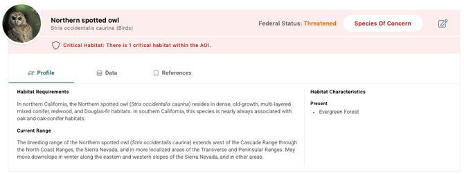
- Species of Concern: Species with one or more suitable habitat characteristics and critical habitat, element occurrence, or other primary data present in the project area. This indicates a high potential for that species to occur in or near the project.
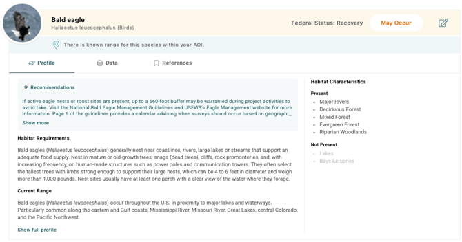
- May Occur: Species with one or more suitable habitat characteristics present and the project is within one of the species range types. This indicates that the species may occur in or near the project.
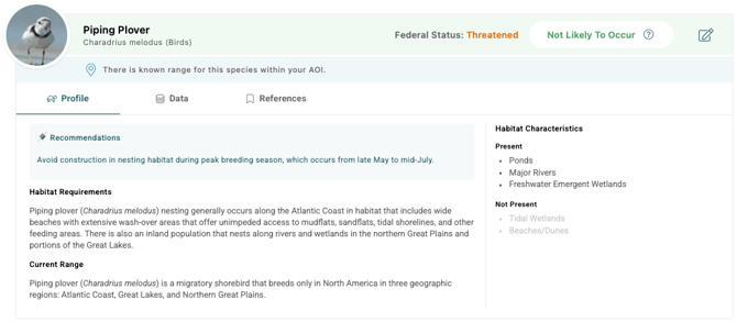
- Not Likely to Occur: The species is unlikely to be present due to missing habitat, being outside primary range (if defined by that state), or being within an exclusion zone.
Transect Reports offer "overrides" to customize the species concern levels. This allows you to tailor reports to specific needs, focus on crucial data for a particular project, or exclude irrelevant species. Check out this article to learn more about overriding Species Concerns.
Identifying Species Concern Levels in a Transect Report
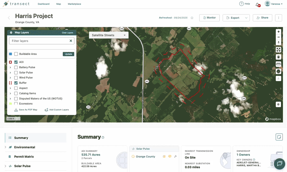
Location within your AOI or Buffer
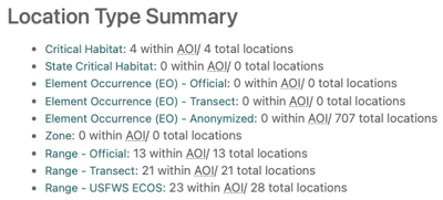
Your Transect Report includes many different resolutions of species location types that intersect with your project area of interest (AOI) or buffer. This location data in a Transect Report can be viewed in two ways:
- To view a list of all species organized by type select Species from the left-side menu > State/Federal Location. This page also provides a summary of the species found within each location designation:
- To view the locations organized by species select Environmental > Species > State/Federal Profiles. Next, click the Data tab within the applicable species table.
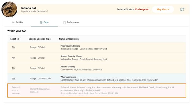
Locations External to your Project Site
Your Transect Report includes species found within both the AOI and buffer, as well as elemental occurrences within 3 miles of your project, to offer helpful context on species movement near your AOI. Click the row to populate a vector on the map where the species was located.
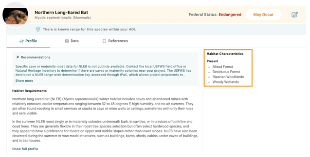
Habitat Characteristics
Habitat characteristics are assigned to each species profile by the Transect Environmental Team based on various datasets (waterways, wetlands, landcover, and more). These characteristics appear under the Profile tab of each species and indicate whether a habitat characteristic is “present” with a ✓ or “not present” with an X.
Primary Areas
If Transect has definitive, high-quality species range data in your AOI's state, Transect will assess if your AOI intersects those primary, known ranges of the species. If the species' primary area within a state does not intersect the AOI, then the species will be considered 'Not Likely to Occur.' Primary areas are included in the Range - Transect data.
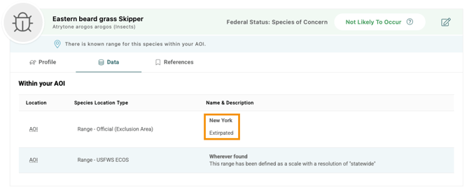
Exclusion Areas
Exclusion areas are those areas where the species has been definitely determined as extirpated (species no longer exists in a specific region) or absent from an area. If Transect only shows exclusion areas for a species on your AOI, then the species concern level will be downgraded to 'Not Likely to Occur.'
Availability of Element Occurrence Data
Transect does not have element occurrence data for all states. When you see official element occurrence data listed in your report, Transect has partnered with a regulator/steward of EO data in the state where your project is located. Transect has also digitized thousands of species locations from sources like the federal register, scientific documents, state-sponsored studies, and more.