
A Transect Report gives you a snapshot of the risk associated with your project area, based on concern levels calculated for species, waters, protected areas, and environmental compliance.
In this article, we'll cover:
- Concern Levels in the Executive Summary
- Species Concern Levels
- Waters Concern Levels
- Protected Areas Concern Levels
- Environmental Compliance Concern Levels
Concern Levels in the Executive Summary
The Executive Summary provides a high-level overview of potential environmental concerns tied to your project. It identifies key resource types and assigns each one a concern level — high, medium, or low — based on available data and project context.
Transect evaluates the following resources:
- Species: Federally and state-protected species within the project area.
- Waters: Potential impacts to wetlands, streams, rivers, floodplains, and other water resources.
- Protected Areas: The presence of federal, state, tribal, local, and other conservation lands.
- Environmental Compliance: A preliminary assessment of potential contamination risks.
The Environmental Compliance information offers a preliminary look at potential environmental contamination or compliance issues that could affect a project's economics, placement, ownership liability, or scheduling. It does not replace a Phase I Environmental Site Assessment.
Each resource category is assigned a concern level based on specific criteria:
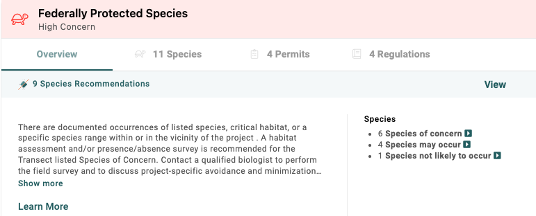
- High Concern (red): These resources carry a high risk of affecting the project footprint, timeline, or budget.
- Moderate Concern (yellow): These resources carry a moderate risk of affecting the project footprint, timeline, or budget.
- Low Concern (green): These resources carry a low risk of affecting the project footprint, timeline, or budget.
Each Concern Assessment also includes:
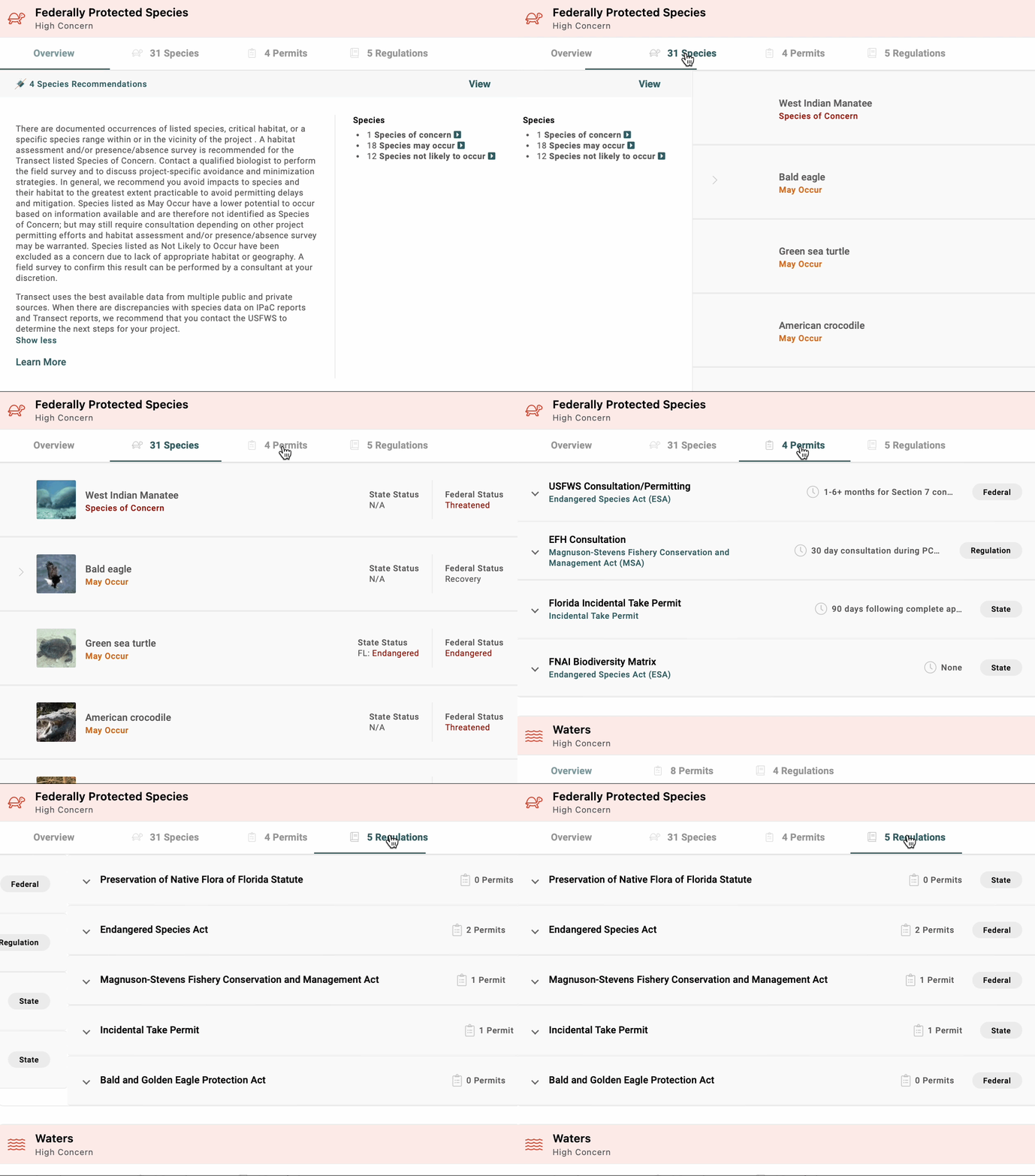
- A summary count of active regulations, permits, and recommendations related to the topic.
- Recommended next steps based on the report's findings.
- A snapshot of the data driving the high, medium, or low concern level.
Click Learn More in the bottom left of any Concern Assessment for more detail on that rating.
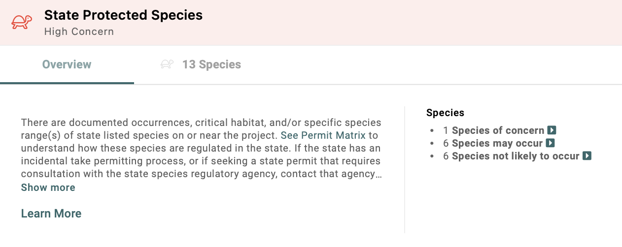
Species Concern Levels
"Species of Concern" is a term used differently across conservation and regulatory groups. Learn more about how species concern levels are determined in this article.
Waters Concern Levels
Waterways, streams, and wetlands are critical to identify during due diligence, since they can affect a project area's viability. Transect identifies these features using federal datasets (NHD and NWI)
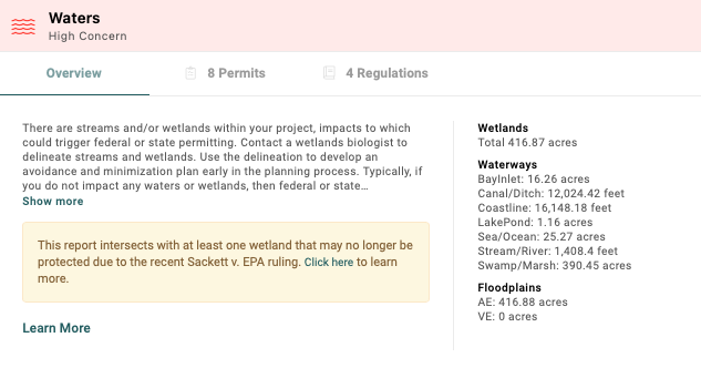
Concern levels are assigned as follows:
- High Concern: The project area intersects wetland areas, waterbody areas, or streams — or waters impact was indicated in the report's context questions.*
- Moderate Concern: There are no NWI wetlands or NHD streams within the project area, but it falls within a FEMA 100-year floodplain.
- Low Concern: The project area does not intersect wetlands, streams, or waterbody areas — or no waters impact was indicated in the context questions.*
Protected Areas Concern Levels
Protected lands span a vast network of federal, tribal, state, local, and private conservation areas that preserve biodiversity and support recreation. Because these lands are legally protected, understanding a project's proximity to them is essential — development nearby often triggers stricter environmental reviews and permitting, which can significantly affect timeline, budget, and footprint.
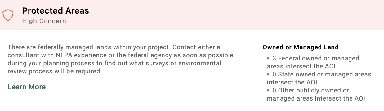
You will see a concern level based on the following information:
- High Concern: The project area intersects any federally owned or managed areas.
- Moderate Concern: The project area intersects state-owned or managed areas, other owned or managed areas, or tribal areas.
- Low Concern: The project area does not intersect federal, state, other, or tribal owned/managed areas.
Environmental Compliance Concern Levels
This section of the report offers a preliminary understanding of potential environmental contamination or compliance issues that could affect a project's economics, placement, or scheduling.
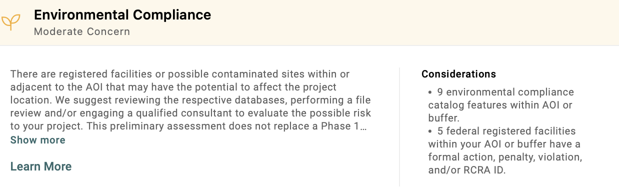
Concern levels are assigned as follows:
- High Concern: Only appears if manually overridden by a user or admin. Learn more about overrides here.
- Moderate Concern: The project area intersects environmental catalog locations, or federal facilities with formal actions, penalties, violations, or RCRA (Resource Conservation and Recovery Act) designations.
- Low Concern: The project area does not intersect any of the areas listed above.