
Smart Sites automates the search for groups of adjacent parcels that collectively meet your target acreage and other criteria — so you don't have to manually prospect parcel-by-parcel for combinations that could work for your project.
In this article, we’ll cover:
- Overview of Smart Sites
- When Smart Sites Is Right for Your Project
- How to Use Smart Sites
- Frequently Asked Questions
Smart Sites is in beta — help us improve it. Share feedback via the Feedback button in Smart Sites, or email Support.
Overview
Instead of clicking through individual parcels, Smart Sites:
- Locates clusters of adjacent land parcels
- Matches your criteria — acreage, parcel count, proximity to transmission lines, buildable area, and more.
- Highlights potential sites you can save as projects or assess further in reports.
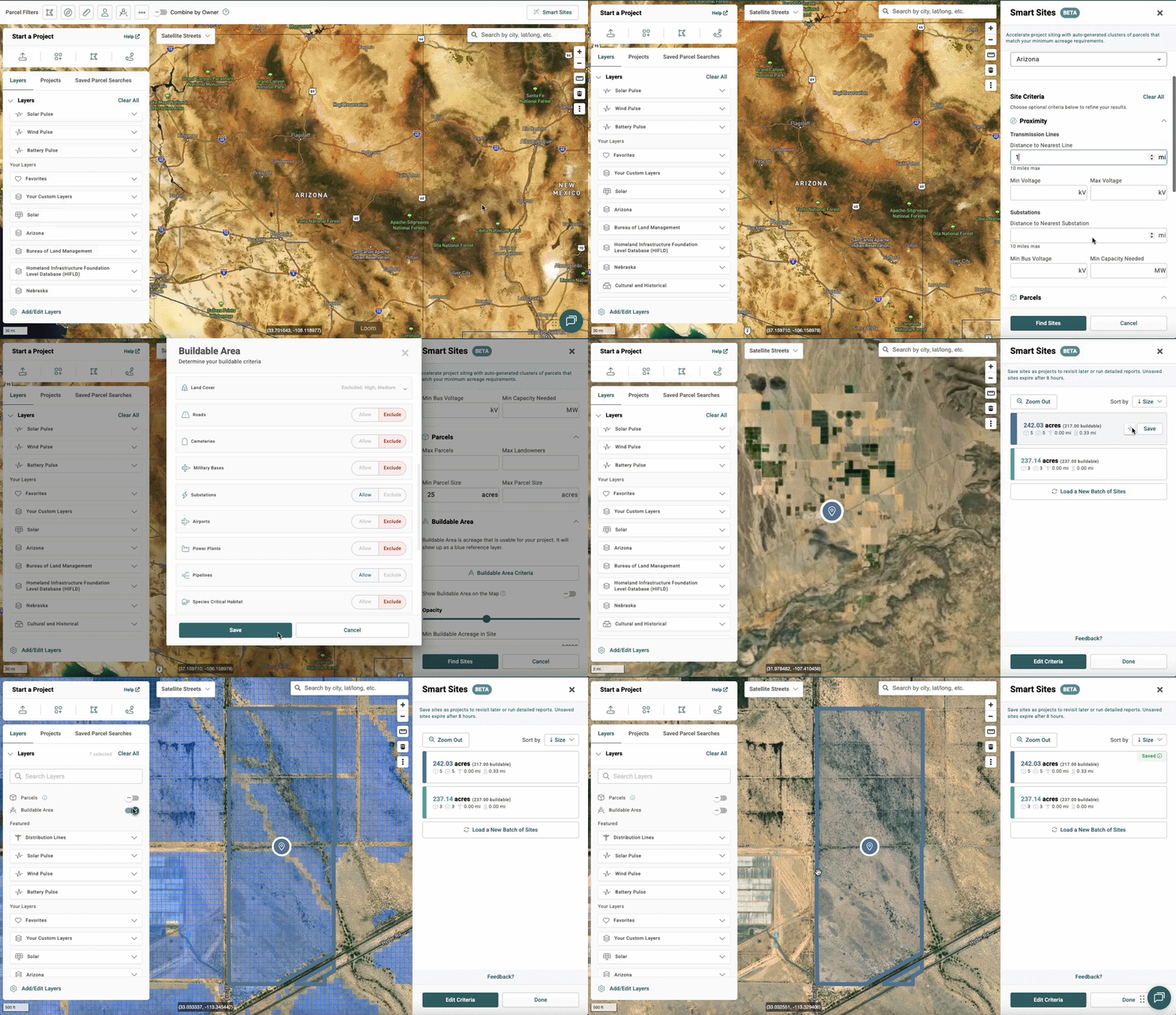
When is Smart Sites Right for Your Project?
Large projects often require multiple adjacent parcels of buildable land, which can be challenging to find in the contiguous United States. Smart Sites works best for:
- Large projects on contiguous parcels: Ideal for utility-scale solar, storage, data centers, nuclear, or other large project types.
- Challenging geographic regions: States where land is scarce and parcels are smaller.
- Complex topography: Areas where environmental constraints make finding large, flat sites difficult.
How to Use Smart Sites
Add Filterable Criteria
- Open the Map from the top navigation bar in Transect.
- Select Smart Sites
 in the upper-right corner of the Map.
 - Define your site's core criteria: minimum size, maximum size, and location (city, county, or state).
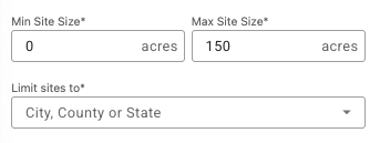
- Optionally, refine further with:
- Proximity — distance to transmission lines or substations.
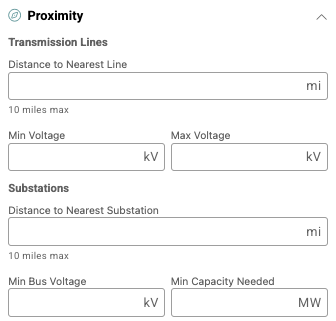
- Proximity — distance to transmission lines or substations.
-
- Parcels — count or ownership constraints.

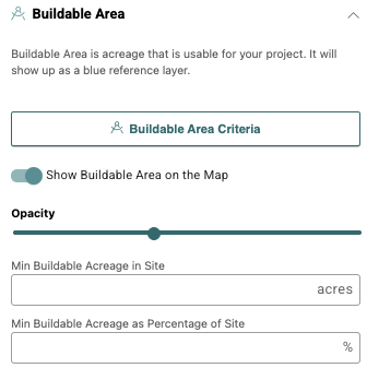
- Buildable Area — usable land after environmental constraints.
- Parcels — count or ownership constraints.
Review Potential Sites
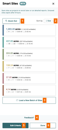
Once Smart Sites identifies candidate sites, you can:
- Zoom Out to see all the sites within your search area.
- Sort by size, buildable acreage, parcels, landowners, distance to transmission lines or substations.
- Load a New Batch of Sites o bring in more matching results, if available.
- Leave Feedback on your results or on the feature itself.
- Edit Criteria to refine and re-run your search
- Click Done to exit out of the Smart Sites modal.
Smart Sites results expire 8 hours after generation. You can revisit a previous search by reopening the Smart Sites icon  in the Map.
Each site in your results list includes at-a-glance icons showing:
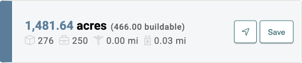
 : acreage of the site.
 : buildable acreage, based on your selected Buildable Area Criteria.
 : number of parcels.
 : number of owners.
 : distance from the closest transmission line.
 : distance from the closest substation.
 : zoom to the site’s location in the Map.
 : save the site as a project, or run a report.
Frequently Asked Questions
Can I use Smart Sites to identify available land?
Smart Sites evaluates technical suitability — acreage, buildable area, proximity, and similar criteria. It doesn't indicate whether a landowner is currently willing to lease or sell. Treat results as your strategic starting point for outreach and diligence, not a list of available land.
Can I filter by ISO or RTO boundaries?
Not currently — Smart Sites only supports search by state, county, or city. If you search a state that spans multiple ISOs (Texas, for example), results may include configurations that cross market boundaries, such as ERCOT and SPP.
Is Smart Sites suitable for all types of development?
No. It's built for utility-scale projects sited on clusters of adjacent parcels. It's not the right tool for linear projects (like pipelines or transmission routes) or projects that only need a single parcel.