Transect provides a dataset called the "Derived Map of Global Electricity Transmission and Distribution Lines,” which is a valuable tool for renewable energy project developers. It helps identify potential grid connection points, assess grid capacity, and plan grid integration for renewable energy projects.
In this article, you will learn about:
- Overview of the Distribution Line Data
- How to locate Distribution Line Data in the Map
- How to locate Distribution Line Data in a Report
For information on local hosting capacity, check out our Distribution Lines add-on.
Overview of the Distribution Line Data
Transect provides a dataset called the Derived Map Of Global Electricity Transmission And Distribution Lines, From Paper: Predictive Mapping Of The Global Power System Using Open Data.
The purpose of the dataset is to answer an important question: where is the existing electricity infrastructure? This dataset is a collaboration between ESMAP, Facebook, KTH, WRI and the University of Massachusetts Amherst. Together, they created an algorithm for estimating the location of existing medium-voltage infrastructure.
This data predicts the locations of existing infrastructure and connections. The model uses "night lights" seen on satellite imagery taken at nearly every point on earth monthly around 1:30am. The night light images are then filtered to highlight particularly bright surroundings, and then refined by combining other satellite data to include only areas with human activity. The model also assumes that electric lines likely parallel roads.
According to the paper:
[The] tool applies multiple filtering algorithms to night-time light imagery to identify locations most likely to be producing light from electricity. These light sources (target locations) are then connected to known electricity networks through a least-cost routing algorithm following roads and known distribution lines (adopted from OpenStreetMap). This results in connected networks at two voltage levels we define as high voltage (HV, >70 kV) and medium voltage (MV, 10–70 kV).
The dataset is then validated by comparing the model data to 16 electricity networks across 14 countries representing High, Upper-Middle, Lower-Middle, and Low-income groupings. Across an equal-area grid (edge length 15 km), the model showed a predictive accuracy of 75%.
As this is modeled data, it is a fairly accurate first assessment of electric line locations, but it is not a substitute for more locally-sourced GIS data or fieldwork. Further, as the data is modeled, more specific information like owner contact and voltage is not provided.
Viewing Distribution Line Data in the Map
Within the Map, you can select the following layer to show the Global Electricity Transmission and Distribution Lines:
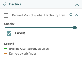
This layer can be activated by checking the box, which showcases both the existing Open Street map lines and those that are derived from GridFinder.

Viewing Distribution Line Data in a Report
Within a Report Map, the Global Electricity Transmission and Distribution Lines layer can be accessed by selecting Catalog Items > Global Electricity Transmission and Distribution Lines. This will highlight any data found within your project’s boundaries that you can easily save to a custom PDF map.
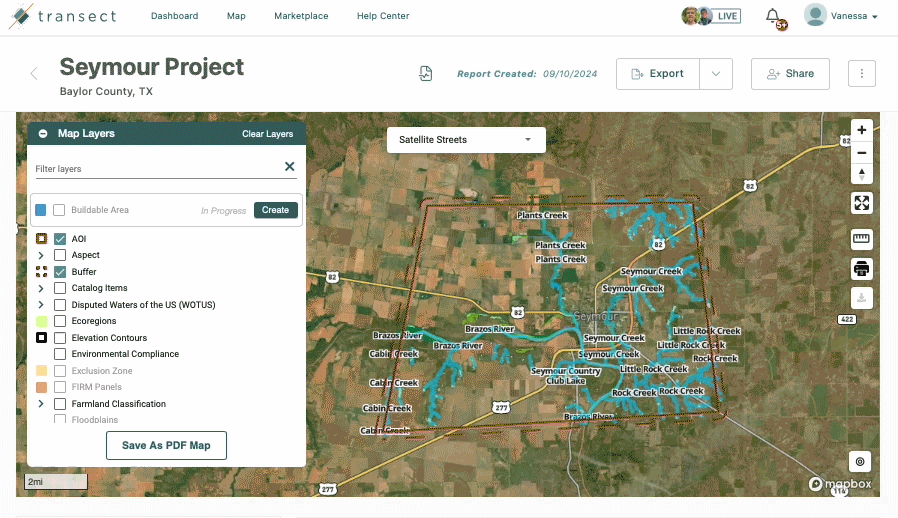
You can also locate this information by navigating to Location Data > Catalog and reviewing the "Electrical" group.
Sources
Arderne, C., Zorn, C., Nicolas, C. et al. Predictive mapping of the global power system using open data. Sci Data 7, 19 (2020). https://doi.org/10.1038/s41597-019-0347-4
Antoine, R., Arderne, C., Rogate, C. Using night lights to map electrical grid infrastructure. World Bank. April 29, 2019. https://blogs.worldbank.org/energy/using-night-lights-map-electrical-grid-infrastructure