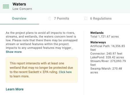
The Supreme Court’s ruling in Sackett v. EPA narrowed the definition of federally protected wetlands, introducing regulatory risks for developers. In response, Transect developed the Disputed Wetlands feature. Using advanced spatial algorithms, this tool identifies potential wetlands that may no longer be subject to federal jurisdiction under the new CWA framework.
Key Features
When a project site intersects a wetland with uncertain regulatory status, Transect Reports provide:
- An Executive Summary Alert: A notification within the Waters card advising that their AOI intersects a Disputed Wetland.
- A Map Layer: A "Disputed Wetlands" map layer to easily visualize affected areas.

Classification Criteria
Transect considers a wetland "non-disputed" if it meets one of the following criteria:
- The wetland is directly connected to any navigable water.
- The wetland is adjacent to or connected to any non-disputed water identified in criterion #1.
Wetland features (NWI) that do not intersect hydrography (NHD) features (perennial, intermittent, or artificial paths) are identified and marked as "disputed."
Resources
*Disputed Wetlands still await official definitions from EPA and the United States Army Corp of Engineers.